
How to See Your Photos on a Map
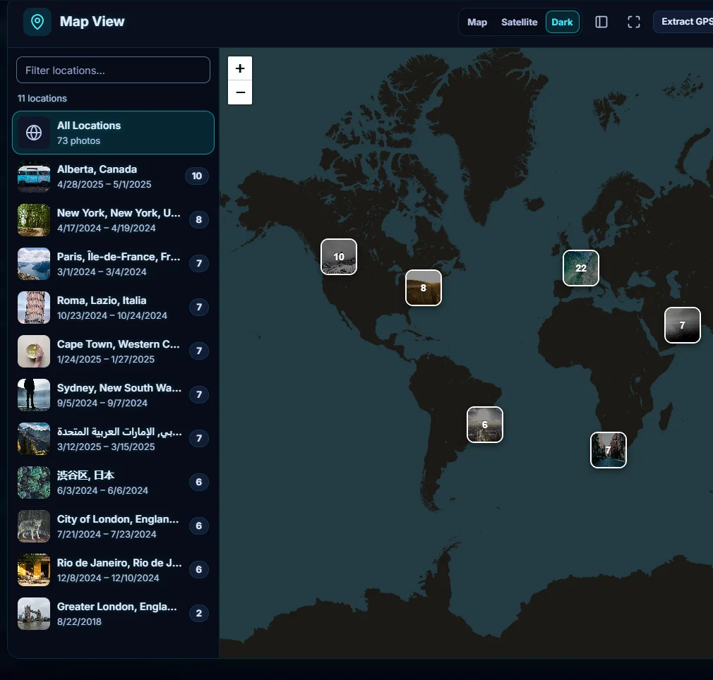
Open Places, then Map. Photos with GPS data are clustered on the map and listed by place. Click a place to zoom in and see its photos. Map pictures and place names are loaded online.
Requires Pluto Photos Pro (one-time $29, no subscription). The free download includes a 30-day trial of every Pro feature.
#1. Open Map View
Open the Places menu and choose Map. Photos that carry GPS data are placed on the map in numbered clusters, and the header counts them (73 geotagged photos here). The list on the left gives each place with its dates and photo count, and Filter locations... narrows it.
#2. Click a place to zoom in
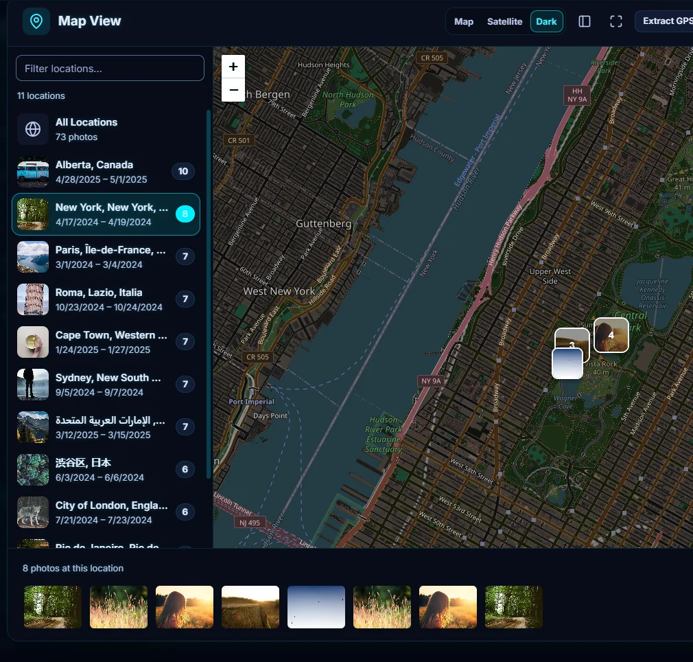
Click a place in the list, or a cluster on the map. The map zooms to it, and a strip along the bottom shows the photos taken there (8 photos at this location).
#3. Switch the map style
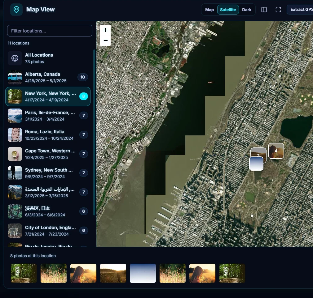
The buttons at the top switch between Map, Satellite and Dark. Satellite is useful for finding the exact spot of a hike or a beach.
#4. Read GPS from photos that are missing it
If photos you expect are missing, click Extract GPS Data. It reads the location from the photos and from Google Takeout files, and the count in the header goes up.
#Tips
- The map needs the internet. The map pictures come from OpenStreetMap (and Esri for satellite). Place names such as "Alberta, Canada" are looked up by sending a photo's coordinates to OpenStreetMap's Nominatim service, once per roughly 1 km area. Your photos are not uploaded.
- Photos without GPS don't appear. Phones usually record it, and many cameras don't.
- Before you share a photo, you may want to remove its location.
#Questions
- Does the map work offline?
- The map pictures and place names are loaded from the internet, so you need a connection to see them. Your photos themselves are not uploaded.
- Why are some photos not on the map?
- They have no GPS data. Try Extract GPS Data, and keep in mind that many cameras do not record location.
About the smart search · Pricing · Download Pluto Photos · Contact support